Tuesday, July 18, 2017

Skagen, Denmark –

I apologize for being so far behind.  We’ve been home for several days and I need to finish posting about our last port of call.  There have been so many things to catch up on, but now it’s time to write about Skagen.

July 7 –

Skagen, Denmark –

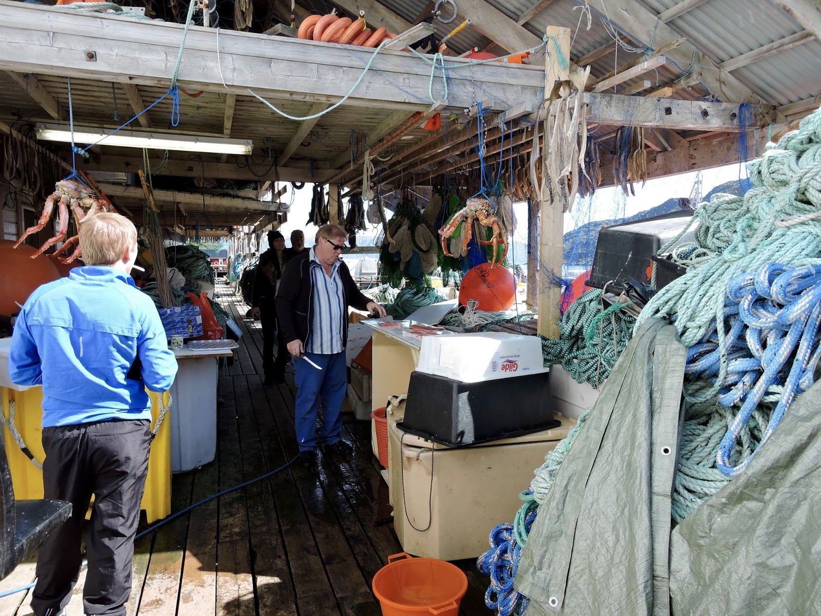
This little fishing town lies at the northernmost tip of Denmark and the Jutland peninsula. There are lots of very big fishing vessels in the bustling harbor.  This is the center of the herring fishing industry.  From these ships come much of the herring that gets pickled and sent to the rest of Europe.
Some large herring fishing boats

Our tour started with a drive through some of the old town which is quite picturesque.  The houses are primarily bright yellow with red tile roofs.  From town we drove out to the very point of Jutland to a place called Grenen.  This is the place where the North Sea and the Baltic meet.  The terrain is absolutely flat with only scrubby growth because the ground is only sand.  We learned some interesting things about this place.  Because of the action of the sea and wind, the spit of land is growing at the rate of about 3 meters (nearly 10 feet!) each year. Sand piles up from the North Sea side and the land grows.  As a result a new lighthouse has been built about every 100 years.  The peninsula also has lots of old German bunkers which were part of the Atlantic wall meant to prevent invasion.  When we got to the end of the paved road we boarded a tractor bus that drove us to the very end.  There you can stand with one foot in the North Sea and the other in the Baltic.  There were lots of tourists doing just that.a


The end of Denmark - on the left is the North Sea and on the right the Baltic

The lighthouse and our ship in the far distance.  In the not too distant future a new lighthouse must be built because the land is building up so fast.

From Grenen we drove back into Skagen and visited the Skagen Art Museum.  This place was a very popular artists’ colony at the turn of the last century. Several prominent Danish artists made their home here and others visited often.  They were attracted by the scenery, the fishermen and the play of light on the water.  The museum was truly a surprise.  The collection includes hundreds of beautiful paintings, many of which reminded us of works by great French impressionists.  We had a short tour by a museum employee who pointed out some of the more important works.  The visit was too short but it was time to get back to the ship and pack up for disembarkation tomorrow.  If anyone's interested in seeing some of the beautiful paintings, you can see them at this place http://skagenskunstmuseer.dk/en/works/

Skagen Art Museum

Monday, July 10, 2017

Stavanger, Norway

July 6 – 

Today we docked in Stavanger, the Oil Capital of Norway.  This city lies in southwest Norway and has a population of nearly 140,000.  Stavanger was founded in 1125, but there is much history in the area prior to that time.  In fact our first stop on our tour took us to the Swords in the Rock monument next to the Hafrsfjord.  Three large (33 feet tall) bronze swords are planted into a rock on a little hill by the fjord.  The swords commemorate the battle in 872 when the Viking king Harald Fairhair united all of Norway under his crown. The swords stand boldly next to an idyllic park with ducks and swans swimming past.
Swords in the Rock I picked a photo with people to give some perspective on how big these were.

From the monument we drove to Ullandhaug viewpoint.  From this tower we could see the mountains to the north and all the fertile farmland around.  Unlike most of the rest of Norway we’ve seen, this place actually has more flat land in which some crops can be cultivated.  Additionally because of the Gulf Stream current the climate is pretty moderate with winter lows getting down to an average of 32°.
 
The view from Ullandhaug.  It's very different from the gorges and mountains we've seen in the past few days
Our next stop was the Jernaldergarden farm.  This was a very interesting place. Archaeologists found on the site evidence of an Iron Age farm.  The place has been recreated as it would have been before the Viking era.  There are a couple of low long houses constructed of stones and wood with turf roofs.  The houses are partially buried in the ground for both protection and insulation. The farm is manned by authentically costumed interpreters, much as Colonial Williamsburg is.  Our guide was the chief farmer of the place.  He took us into one of the long houses and explained about life in his era.  Among other things he showed us how the wool from the farm's sheep was spun into threads to make the clothing he was wearing.  In that time frame there were no spinning wheels so he used just a wooden spindle.
Home sweet home!


Inside a long house
A spinning demonstration

The farm raises sheep and cows and as we walked along we had to watch out for cow and sheep patties.  The sheep were all black and very curious; they came right up to us.  I can tell you that I’m very glad I don’t live in that era.  The average life expectancy was about 40 and it’s a wonder that it was that much!
Some nice looking sheep

Our host

Our final stop was the Oil Museum, an appropriate place given the fact that Stavanger is the city most involved with the Norwegian oil industry. I didn’t have big expectations of this place, but it turned out to be very interesting.  We were able to see the equipment used for drilling the offshore wells as well as some video footage of what it is like on the platforms out in the North Sea.  There were also diving bells to see how divers are able to work outside at as much as 400 meters below the surface.  Our most overwhelming impression was that the people who work in the industry must be really tough.  They are paid well, but the risks they take are very large.  I can’t remember if I mentioned it earlier, but the oil and natural gas industry comprise 20% of Norway’s GDP.  Before gas and oil were found in the North Sea Norway was one of the poorest countries in Europe.  It has made a tremendous difference in the lives of the population.
A
scale model of one of Norway's oil platforms
 
A diving bell - three men go down in this thing and must stay for several days to decompress after diving

A very large drill bit!
Norway's oil revenue clock showing at that moment it has brought 8 trillion Krone to the country, about 1 trillion dollars


After our visit to the museum it was time to head back to the ship.  Tied up near our ship was the Sea Cloud II, a lovely sailing cruise ship.   As we watched two men went up the rigging to work on the spars.  I wouldn't want to do that in rough seas! 
Sea Cloud II
A high perch!


This was our last port in Norway and as we headed out to the open sea we said goodbye to this beautiful country.  The scenery we’ve seen in the last days has been absolutely spectacular.

Thursday, July 6, 2017

Bergen, Norway

July 5 –

We awoke to a beautiful sunny and warm day in Bergen. This is the second largest city in Norway with a population of nearly 280,000.  The metropolitan area has nearly 420,000 people.  The city is very picturesque.  The city center and northern neighborhoods lie on Byfjorden, the city fjord.  It has a large harbor and the city itself is ringed by seven mountains.  Legend has it that seven trolls came to the area looking for a place where they could sleep out of sunlight (trolls turn to stone in the sun). They picked this place because it gets so much rain and they thought they would be safe. They fell asleep and to their great misfortune Bergen  had a sunny day.  They turned to stone and now are the granite mountains ringing the city.

A little aside.  We have been incredibly fortunate with the weather on this leg of our voyage.  Every place we’ve stopped in Norway we’ve been told, “Oh, you are so lucky. The last two weeks the weather has been awful.”  Perhaps the country needs to pay us to come!

Back to Bergen.  The city was founded in the late 11th century.  By the late  13th century it was a major trading center of the Hanseatic League, which was a powerful confederation of merchant guilds from northern Germany.  For a long period of time it dominated all trade in the Baltic and up the coast of Norway to Bergen.  In the old city of Bergen you can see the old trading houses.  They were made of wood and the water side of the buildings could be opened so that ships could be tied up right next to them to load and unload. 
 
The yellow buildings on the right are in the Hanseatic style.  The dormer on each was actually a place for a winch to raise and lower cargo.
Our tour this morning took us first to the Ulriken cable car for a quick ride up to the summit of Mount Ulriken, the highest of the seven peaks around the city.  At the top we were at approximately 2000 feet. An interesting piece of trivia our guide told us.  The cable car ride takes about 7 to 9 minutes.  A couple of years there was an extreme mountain bike competition in Bergen.  Someone rode his mountain bike down in 3 minutes!  And he survived!  The view from the top was great.  We could see the various districts spread beneath us.  I forgot to say that along the way we drove through the old town and across the bay to a newer section (still several hundred years old).  The city has had many fires because most of the buildings are made of wood so most are not original.  They are still old by our American standards.
Bergen from Mount Ulriken
New "old" Bergen

After descending we proceeded to our next stop, the Fantoft Stave Church.  A stave church is a wooden structure which uses no nails to hold it together.  It’s basically put together like a puzzle with posts and lintels holding everything in place.  This type was very common in northern Europe centuries ago but few remain.  The Fantoft Church was originally built around 1150 in a village on the Sognefjord (we were near there a few days ago).  In the 19th century it was threatened with demolition.  A man from Bergen saved it by having it taken apart and moved to Bergen.  Sitting in a wooden structure that old is quite remarkable.  The roof is quite interesting.  It’s decorated with crosses and dragons.  Both symbols were meant to ward off evil, one in Christianity and the other in Norse mythology.
 
Interior of the Fantoft Stave Church
Dragons on the roof
And crosses


After leaving the church we headed back to the city center passing through a tunnel which took us to the north side.  The Norwegians are great diggers.  After passing through more of the old city we opted to leave the tour and walk around through the old Hanseatic district and have lunch there.  Our guide had recommended one named Bryggen Tracteursted. We haven’t a clue what it meant but after wandering a little we found it.  It occupied an old wooden building with a slate floor which sloped down toward the water.  The waiter told us this was not the original building; it was the new one.  The original burned in a big fire in 1703.  The new one was rebuilt in 1708.  Very modern, right?  Definitely this was not McDonalds.  After a nice lunch we walked along the waterfront past the old fortress and back to the ship.
The Bryggen Tracteursted Restaurant (the new one built in 1708)

Sailing from Bergen is pretty spectacular too.  We sailed under two large suspension bridges and through an archipelago of little islands for a couple of hours before heading out in the sea.
One of the two suspension bridges we sailed under


For no particular reason I'm adding this photo of the shipload of timber following us out.  Do you suppose he's headed to a furniture factory in China to make things which will be shipped back here to Norway?  Who knows.

We thought Bergen was a very charming city.  I think it would warrant another visit or a longer stay.  Once again we were impressed with the cleanliness and the friendliness of the people.

Wednesday, July 5, 2017

Loen, Norway

July 4 –

Today we anchored in the fjord at Loen.  We were supposed to anchor in Olden, the next arm of the fjord from ours, but for some operational reason we had a change.  It was supposed to be rainy today, but when we disembarked for our tour it looked pretty promising.

Today’s tour was an all day one that took us to some of the most spectacular scenery yet.  We set out in our bus with our guide Olav along the fjord to the town of Stryn. This is the largest town in this area with a population of 7000.  From Stryn we headed away from the fjord following a river which led us to Stryn Lake which has the most beautiful turquoise water.  The water comes from the glaciers on the surrounding mountains and is crystal clear.
Stryn Lake
A picturesque village on the lake

Our drive continued on winding roads and through several tunnels up into the mountains where we stopped at a place called Djupvasshytta at an elevation of about 3500 feet.  Here in this place well above the tree line is a lake which just in the last two weeks finally became ice free.  There were still some ice floes floating in it. The surrounding landscape is pretty desolate. All around are snow covered peaks, some with glaciers.  We had a brief stop in a hotel there for some coffee and then set out for “the roof of Norway.”  Our destination was up a hair-raising road that climbs to the summit of Mount Dalsnibba.  At the top we were at close to 5000 feet above sea level.  The road is privately owned and was just paved  and had guard rails added in the last few years.
 
Lake next to the hotel at Djupvasshytta.  You may be able to see little white specks in the water.  Those are ice floes.
At the top are a viewing platform and a gift shop.  From the platform you can look down to Geiranger Fjord, one of the top three tourist destinations in Norway.  The weather gods once again smiled on us so we had a wonderful view down to the fjord where three cruise ships were anchored.  Along the road on the way up and all around the viewing area were hundreds of little piles of rocks purposely stacked.  These are called varda in Norwegian and people build them because supposedly you will return to this place if you do.  The varda actually have a different origin though.  Before modern communications, the Norwegians had developed an early warning system in the event an aggressor was approaching.  Atop a stack of rocks they would light a fire to alert the countryside.  The flames could be seen from one mountain to the next and the population would be warned as each succeeding varda was lit.  The signal would tell the local men to gather whatever weapons they had and meet in a designated place for their community.
Geiranger Fjord 5000 feet below
A varda

Another interesting thing along the roadway was a series of little wooden sheds.  Up in these mountains needless to say they get lots of snow.  Black dirt is stored in the sheds.  As spring approaches, road workers were sent out to the sheds to remove the black dirt and spread it on the roadway.  This dark material helped to speed up melting.  Or at least that’s what Olav told us.
Little shed for black dirt.  I wouldn't want to be sent out to spread it with 15 or more feet of snow everywhere.

From Dalsnibba we took the winding road down to Geiranger stopping along the way to take photos of the Flydal Gorge, the most photographed sight in Norway. At this spot you can see the town and fjord below with the tremendous cascade of water pouring down from the heights above.  In the town we had a very nice lunch in the Hotel Union. Of course the main course was fish.  What else would it be in this country that has such a huge fishing industry?
 
Another view of Geiranger from lower down the road
The waterfall rushing down at Flydal

After lunch we boarded a ferry for a trip along the fjord.  This was the commercial ferry which carries people, cars and buses from Geiranger to Hellesylt at the other end of the fjord.  Along the way we were treated to a water level view of the many waterfalls along the sometimes very sheer walls.  At the other end we reboarded our bus and started back to Loen.  The valleys that we traveled through are some of the few relatively flat lands around so we saw a number of farms and more livestock than we had seen in other places.  The road that we took followed along the old king’s post road built several hundred years ago.  Our weather luck had worn out on us.  As we got off the ferry the raindrops started, but that was okay since we’d been able to see all the sights we were supposed to.

We arrived back at the tender dock and shortly after we boarded we set sail for our next stop Bergen.  The route tonight takes us through the fjords, all of them scenic, but we won’t be staying up to see them.  We have an early tour tomorrow.


Monday, July 3, 2017

Honningsvåg, Norway –


July 1 –

Despite the captain’s warning that we might have some inclement weather, we had a calm night.  We actually got a wake-up call at 11:45 PM (yes, I said PM) because we wanted to see the midnight sun.  As you can see it was nowhere near the horizon.  Thank goodness for sleep masks!
The midnight sun from our veranda

This morning we arrived in Honningvåg on the island of Magerøya.  This is the northern tip of Norway.  Our current position is 70°58.91 N, 025°57.80 E.  About 20 miles from here is Nordkapp which is the end.  We opted to take a tour not to the end but instead to a fishing village called Kamøyvær.  To get there we drove past an arm of the Barents Sea and a fjord or two.  The waters here are full of plankton; hence fishing is good because the cod come to feast on the plankton.  Along the way we saw a few reindeer. Unfortunately we passed them so quickly that I couldn’t snap a photo.  The reindeer are only here during the summer months.  The Sámi people bring them here by boat at the beginning of the summer to graze.  There are no native trees here, just lichens, mosses and some grass.  It’s basically arctic tundra.
These were among the few trees.  They have been planted there and along with the fences are meant to provide avalanche protection for the town below.

We arrived in Kamøyvær which is a tiny village, population 63 people, 7 cats and 4 dogs, on a little inlet filled with fishing boats.  The attraction here besides being able to see some fishermen and their catches is a place called the Gallery East of the Sun.  The artist is a transplanted German woman from Nuremburg named Eva Schmutterer.  More than 20 years ago she met and married a man from this place.  He didn’t want to live in Germany so they settled here.  Eva was in the gallery and explained her work to us.  It is very unique, unlike anything we’d seen before.  She creates collages from old magazines.  On the back of the work you can see it’s a collage, but the front is in vivid color and can best be described as resembling stained glass or modern impressionism.  All of her work portrays the natural vistas here. Her art is unique and clearly shows the stark beauty of this place.
Gallery East of the Sun

When we left the gallery we walked to a nearby fisherman’s building.  He must have just come in because he was cleaning some fish.  He had a couple of huge king crabs hanging.  Of course I had to take a photo of an old Virginia crab with a Norwegian one.  Once again I was struck by the wind-burned faces of the fishermen and their reddened and gnarled hands.  To do this for a living in this place takes a very tough person.
Fishing harbor in Kamøyvær
Fishermen working on their catch
Drying some of the catch
Two crabs - one from Virginia, one from Norway

We drove back to town and made a stop at one of only a couple of ice bars in Norway.  The place is completely constructed of blocks of ice cut from a local lake each spring.  There were three ships in town today so the place was packed with people and totally chaotic.  We left before getting anything to drink because it was just a mad crush of people.

I forgot to mention that earlier in the day we stopped in a little shop directly behind where we were docked. It was a shop run by some elderly Sámi women. I say elderly but I don’t really know that.  Anyway, everything for sale was a product made from reindeer. There were pelts, antlers, knives, utensils etc.  We weren’t in the market for any of it and I’m not sure we could even bring some of it into the country.  Al asked one of the ladies if he could take a photo since she was dressed in traditional garb.  After he did she began talking in what must have been the Sámi language.  It sounded almost Russian to me, but who knows.  The only word that sounded remotely like anything we knew was something like “capitalismo,” at least we think that’s what she said.  We offered to pay her for letting us take her picture, but that evidently wasn’t what she wanted.  We finally said goodbye and went on our way. 
Sámi Lady in full costume
Parking the zodiacs in the Quest's marina
The ferry to the mainland and the rest of coastal Norway

One other interesting thing we learned about this place which is at the northernmost point of the European continent.  Near the end of WWII as the Russians were advancing including to Honningsvåg, the Germans occupying the place burned everything to the ground.  The only structure left standing was the church.  The residents who were here took refuge in the church and in caves until houses could be rebuilt, no small feat since there is no timber here and materials had to be brought in by boat.  Additionally it was winter when this happened. I can’t even imagine what the people endured!


Not the most exciting photo, but this is the northernmost point in Europe

After we left Honningsvåg since it was such a calm evening the captain sailed us around the island past the North Cape.  It was around 11 PM, still very light, but a few clouds and sea fog were over and beneath the sheer cliffs of the cape. It looked very mysterious.  It was another lovely day here in the Arctic Circle.  Now we head south again.

Saturday, July 1, 2017

Tromsø, Norway

June 30 - 

We arrived this morning to Tromsø, Norway, the most populous city north of the Arctic Circle in Norway. It has a population of around 70,000 but when students are here at its university there are around 85,000.  There is a large university in Tromsø which offers programs in many disciplines; additionally there is a very large teaching hospital affiliated with the university.  The hospital employs 6000 people and has 4000 beds, which makes it very big indeed.

Tromsø is on an island at more than 69° N latitude.  Once again because of the influences of the Gulf Stream and its offshoots it supposedly doesn’t get as cold here.  That’s according to our guide, but we find it hard to believe that we Virginians wouldn’t be frozen popsicles.  Interesting to us was the fact that the streets in the city are constructed with heating pipes beneath them to help keep them clear of snow and ice.

Today we had a tour with our guide Silke.  We’ve only had one actual Norwegian guide. Today’s was originally German. Yesterday we had a Brazilian and the day before a Canadian.  They’ve all come here for vacation and stayed.  What adventurous people!

We set forth and first passed through the university and hospital.  As I mentioned earlier the university is large; apparently for people living in northern Norway this is the place to go.  The hospital looked huge and there is more construction going on building a cancer treatment center with the latest technologies.  Particularly interesting to us was that next to the hospital was a high rise building that is a hotel for family members of patients being treated. It’s evidently subsidized so the cost is low and people who come from the northern areas can be close when loved ones are hospitalized.

We passed a lovely botanical garden on our way to our first stop, the Tromsø Museum. The museum is dedicated to the Sámi people.  These are the indigenous people who live in the northern parts of Norway, Sweden and Finland.  People know them primarily as reindeer herders, but they evidently produce many arts and crafts.  Evidence has been found of Sámi people living in these parts since 8000 BC.  The museum was very interesting with displays of artifacts showing how these people live and use every part of what’s available to them.  Every part of the reindeer is used for something.  We also saw a video explaining the northern lights.  Apparently they are constantly occurring, but because we are here in summer when there is no real darkness, we can’t see them. We won’t ever get here in the winter, but they must be incredible to see, especially when the surrounding mountains are covered in snow.
This is essentially a Sámi suitcase which is pulled along behind a sled.
A Sámi house which is essentially a sort of teepee made of birch logs and reindeer hides.  The Sámi are nomadic people so their houses are not permanent structures.
Sámi utensils and decorations carved from reindeer bones and antlers

From the museum we went next across a bridge connecting the island of Tromsø with the mainland.  There we went to the cable car at Fjellheisen.  The cable car ascends about 1400 feet and from the summit we had a magnificent view of Tromsø across the water and the surrounding mountains.  Believe it oar not, we had three cruise ships here today.  The other highlight of the trip up the cable car is to have a Norwegian waffle in the café.  You can dress the waffle with blueberry jam, whipped cream and a brown sweet local goat cheese.  It was all good!
Tromsø from the Fjellheisen summit
It was so beautiful I had to add one more shot.

After we descended we stopped next at the  Arctic Cathedral on the mainland side.  The cathedral is actually a parish church, but its distinctive design has earned it its name.  It’s made primarily of concrete in a triangular shape with a very large stained glass mosaic at one end.  It’s a Lutheran church (that’s the principal religion in Norway) and the venue for many concerts because of the great acoustics.
Stained glass window behind the altar in the Arctic Cathedral
The Arctic Cathedral from the Tromsø side. It's the white triangular structure in the middle.
After our visit there we crossed back over the bridge to Tromsø city and after passing through the old town we headed back to the ship.  Once again we were impressed with the cleanliness of the place, the friendliness of the populace, and the hardiness of the people.  To live in a place which in winter has at the solstice not even a minute of sunshine takes a particular kind of individual. Silke told us at the winter solstice the sun doesn’t make any appearance at all.  There is only at best twilight.  I’m not sure I would like that.

We sailed at 5:30 PM and headed north to our next stop Storstappen Island and Honningsvåg. As we sailed along, seagulls were having a good time drafting alongside us.  Al got some pretty good shots of them.
Catching a draft from the ship
A high flyer

We were supposed to take a zodiac tour to see birds in Storstappen, but after thinking about it, we changed our minds.  It’s cold out on the water!  And our captain told us we may have inclement weather, so perhaps we made a wise decision.  We’ll see.  More later.

-->